Geolocate

Al Qala topographic map

Click on the map to display elevation.

About this map

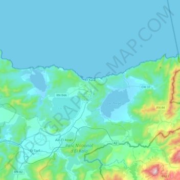
Name: Al Qala topographic map, elevation, terrain.

Location: Al Qala, El Kala District, El Tarf, Algeria (36.80091 8.13587 36.95204 8.54365)

Average elevation: 88 m

Minimum elevation: -4 m

Maximum elevation: 874 m

Gear up for your next adventure:

Camping Tent - Weather-resistant tents suitable for 2 to 6 people
🧭GPS Outdoor Watch - Smart watch for navigation and fitness tracking in nature
🧢Sun Hat - Wide-brim hat for sun protection
🔭Outdoor Binoculars - Lightweight binoculars for birdwatching and hiking
🧶550 Survival Paracord - Versatile utility cord for emergency repairs and rigging

As an Amazon Associate, this site earns from qualifying purchases at no extra cost to you.