Geolocate

Basantpur topographic map

Click on the map to display elevation.

About this map

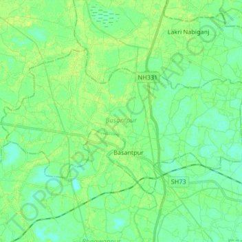
Name: Basantpur topographic map, elevation, terrain.

Location: Basantpur, Siwan, Bihar, 841311, India (26.15078 84.58932 26.22337 84.72455)

Average elevation: 62 m

Minimum elevation: 56 m

Maximum elevation: 67 m

Other topographic maps

Click on a map to view its topography, its elevation and its terrain.

Parmanandpur

India > Bihar > Basantpur

Average elevation: 76 m

Gear up for your next adventure:

🧴Sunscreen SPF - Broad-spectrum sunscreen for outdoor activities
🔋Emergency Crank Radio - Weather alerts and power without needing batteries
🧊Insulated Water Bottle - Keeps drinks cold in summer and prevents freezing in winter
👖Convertible Hiking Pants - Zip-off legs to adapt to changing weather conditions
🛁Quick-Dry Microfiber Towel - Space-saving towel that dries rapidly on the move

As an Amazon Associate, this site earns from qualifying purchases at no extra cost to you.