
Bantul topographic map
Interactive map
Click on the map to display elevation.
About this map
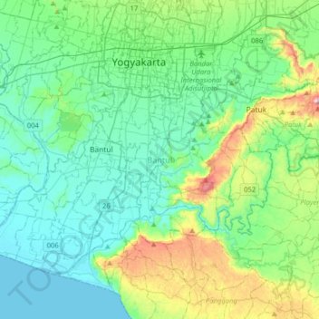
Name: Bantul topographic map, elevation, terrain.
Location: Bantul, Daerah Istimewa Yogyakarta, Indonésie (-8.02815 110.20385 -7.76802 110.52131)
Average elevation: 128 m
Minimum elevation: 0 m
Maximum elevation: 608 m