Geolocate

Reichenbach topographic map

Click on the map to display elevation.

About this map

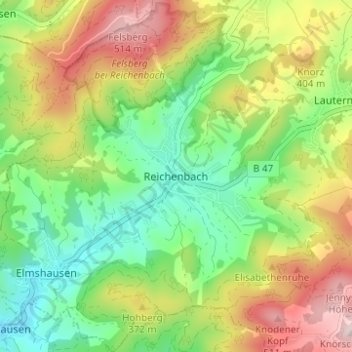
Name: Reichenbach topographic map, elevation, terrain.

Location: Reichenbach, Lautertal, Kreis Bergstraße, Hesse, 64686, Germany (49.69285 8.67283 49.73285 8.71283)

Average elevation: 314 m

Minimum elevation: 160 m

Maximum elevation: 537 m

Gear up for your next adventure:

🦶Hiking Shoe Insoles - Added support for high arches and long days on feet
🕯️Camping Lantern - Illuminates your entire campsite with high-efficiency LEDs
🥾Waterproof Hiking Boots - Boots keeping your feet dry in wet conditions
🔋Solar Power Bank - Keep your GPS and devices charged during long outdoor trips
🥾Mountain Hiking Shoes - Shoes with superior grip for mountainous terrain

As an Amazon Associate, this site earns from qualifying purchases at no extra cost to you.