Geolocate

Ranggu topographic map

Click on the map to display elevation.

About this map

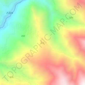
Name: Ranggu topographic map, elevation, terrain.

Location: Ranggu, Dêrong County, Kardze, Sichuan, 627900, China (28.65349 99.36188 28.69349 99.40188)

Average elevation: 3,170 m

Minimum elevation: 2,410 m

Maximum elevation: 4,003 m

Gear up for your next adventure:

🔦LED Flashlight - Powerful and long-lasting flashlight for camping and emergencies
🧼Travel Hand Sanitizer - Keep hands clean when water is scarce
🧤Insulated Winter Gloves - Heavy-duty protection for sub-zero Canadian adventures
🧥Packable Rain Jacket - Breathable waterproof layer for unpredictable weather
Lightweight Backpacking Tent - Compact tent for efficient hiking trips

As an Amazon Associate, this site earns from qualifying purchases at no extra cost to you.