
Make a donation
Gear up for your next adventure:
As an Amazon Associate, this site earns from qualifying purchases at no extra cost to you.
Piera topographic map
Click on the map to display elevation.
Make a donation
Gear up for your next adventure:
As an Amazon Associate, this site earns from qualifying purchases at no extra cost to you.
Piera
Tiene una superficie de 57,3 km² y una altitud media de 324,7 m. Piera cuenta con más de 15 000 habitantes empadronados. Esta población aumenta considerablemente en el verano a consecuencia de las segundas residencias.
Make a donation
Gear up for your next adventure:
As an Amazon Associate, this site earns from qualifying purchases at no extra cost to you.
About this map
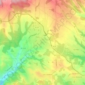
Name: Piera topographic map, elevation, terrain.
Location: Piera, Anoia, Barcelona, Cataluña, 08784, España (41.50169 1.73263 41.54169 1.77263)
Average elevation: 325 m
Minimum elevation: 201 m
Maximum elevation: 437 m
Make a donation
Gear up for your next adventure:
As an Amazon Associate, this site earns from qualifying purchases at no extra cost to you.