
Thank you for supporting this site ❤️
Make a donation
Make a donation
Gear up for your next adventure:
As an Amazon Associate, this site earns from qualifying purchases at no extra cost to you.
Badw topographic map
Click on the map to display elevation.
Thank you for supporting this site ❤️
Make a donation
Make a donation
Gear up for your next adventure:
As an Amazon Associate, this site earns from qualifying purchases at no extra cost to you.
About this map
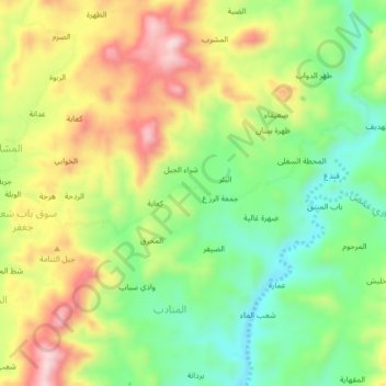
Name: Badw topographic map, elevation, terrain.
Location: Badw, Al Manadib, Al Qafr District, Ibb Governorate, Yemen (14.28288 43.99483 14.32288 44.03483)
Average elevation: 1,156 m
Minimum elevation: 1,018 m
Maximum elevation: 1,330 m
Thank you for supporting this site ❤️
Make a donation
Make a donation
Gear up for your next adventure:
As an Amazon Associate, this site earns from qualifying purchases at no extra cost to you.