Geolocate

Kfardebian topographic map

Click on the map to display elevation.

Kfardebian

Kfardebian (Arabic: كفر دبيان; also spelled Kfar Dibiane and also known as Moucha'a Keserwan) is a municipality in the Keserwan District of the Keserwan-Jbeil Governorate in Lebanon. It is located 45 kilometers north of Beirut. Its average elevation is 1,220 meters above sea level and its total land area is 2,960 hectares.[1] Kfardebian inhabitants are predominantly Melkite and Maronite Christians.[2]

About this map

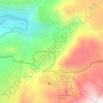
Name: Kfardebian topographic map, elevation, terrain.

Location: Kfardebian, Keserwan District, Keserwan-Jbeil Governorate, 4764, Lebanon (33.98176 35.81487 34.02176 35.85487)

Average elevation: 1,758 m

Minimum elevation: 1,247 m

Maximum elevation: 2,299 m

Other topographic maps

Click on a map to view its topography, its elevation and its terrain.

Blat

Lebanon > Keserwan-Jbeil Governorate

Average elevation: 298 m

Ajaltoun

Lebanon > Keserwan-Jbeil Governorate

Average elevation: 723 m

Gharzouz

Lebanon > Keserwan-Jbeil Governorate

Average elevation: 357 m

Bouar

Lebanon > Keserwan-Jbeil Governorate

Average elevation: 125 m

Jeita

Lebanon > Keserwan-Jbeil Governorate

Average elevation: 316 m

Gear up for your next adventure:

🥫Freeze-Dried Meals - Lightweight, high-calorie nutrition for multi-day treks
👟Sport Hiking Sandals - Breathable footwear for water crossings and camp rest
📷Outdoor Action Camera - Capture high-elevation views and rugged adventures
🕶️Polarized Sunglasses - Reduces glare from snow and water at high elevations
🧴Insect Repellent - Protect yourself from bugs during outdoor adventures

As an Amazon Associate, this site earns from qualifying purchases at no extra cost to you.