Geolocate

Cabrils topographic map

Click on the map to display elevation.

About this map

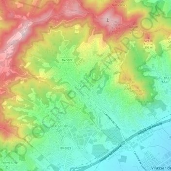
Name: Cabrils topographic map, elevation, terrain.

Location: Cabrils, Maresme, Barcelona, Cataluña, 08348, España (41.50624 2.34763 41.54624 2.38763)

Average elevation: 208 m

Minimum elevation: 18 m

Maximum elevation: 478 m

Gear up for your next adventure:

🧢Beanie Hat - Keep your head warm in cold weather
🥾Hiking Gaiters - Protect legs and shoes from mud, snow, and debris
🩹Compact First Aid Kit - Pre-packed essentials for common trail injuries
🧥Waterproof Jacket - Lightweight rain jackets for hiking and outdoor activities
🧥Ultralight Puffy Jacket - Maximum warmth that packs down to the size of an orange

As an Amazon Associate, this site earns from qualifying purchases at no extra cost to you.