Geolocate

Cuerres topographic map

Click on the map to display elevation.

About this map

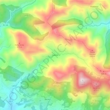
Name: Cuerres topographic map, elevation, terrain.

Location: Cuerres, Cangas de Onís, Asturias, España (43.35142 -5.02801 43.39142 -4.98801)

Average elevation: 402 m

Minimum elevation: 147 m

Maximum elevation: 715 m

Gear up for your next adventure:

🌬️Windproof Camp Stove - Efficient cooking even on exposed mountain peaks
🥾Trekking Poles - Adjustable trekking poles to reduce knee stress and improve stability
🥾Hiking Shorts - Breathable shorts suitable for summer hikes
🚑Survival Whistle - Signal for help across long distances in mountains
🔭Compact Binoculars - Lightweight optics for scouting trails and wildlife

As an Amazon Associate, this site earns from qualifying purchases at no extra cost to you.