
Thank you for supporting this site ❤️
Make a donation
Make a donation
Gear up for your next adventure:
As an Amazon Associate, this site earns from qualifying purchases at no extra cost to you.
Birkhill topographic map
Click on the map to display elevation.
Thank you for supporting this site ❤️
Make a donation
Make a donation
Gear up for your next adventure:
As an Amazon Associate, this site earns from qualifying purchases at no extra cost to you.
About this map
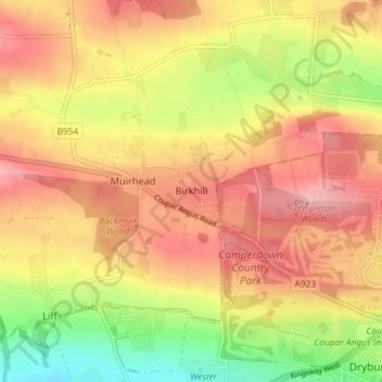
Name: Birkhill topographic map, elevation, terrain.
Location: Birkhill, Angus, Schotland, DD2 5PY, Verenigd Koninkrijk (56.47630 -3.07678 56.51630 -3.03678)
Average elevation: 118 m
Minimum elevation: 37 m
Maximum elevation: 177 m
Thank you for supporting this site ❤️
Make a donation
Make a donation
Gear up for your next adventure:
As an Amazon Associate, this site earns from qualifying purchases at no extra cost to you.