
Thank you for supporting this site ❤️
Make a donation
Make a donation
Gear up for your next adventure:
As an Amazon Associate, this site earns from qualifying purchases at no extra cost to you.
Marbachegg topographic map
Click on the map to display elevation.
Thank you for supporting this site ❤️
Make a donation
Make a donation
Gear up for your next adventure:
As an Amazon Associate, this site earns from qualifying purchases at no extra cost to you.
About this map
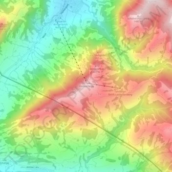
Name: Marbachegg topographic map, elevation, terrain.
Location: Marbachegg, Escholzmatt-Marbach, Lucerne, 6196, Switzerland (46.81459 7.88582 46.85459 7.92582)
Average elevation: 1,159 m
Minimum elevation: 864 m
Maximum elevation: 1,492 m
Thank you for supporting this site ❤️
Make a donation
Make a donation
Gear up for your next adventure:
As an Amazon Associate, this site earns from qualifying purchases at no extra cost to you.