Geolocate

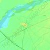
Bhera Tehsil topographic map

Click on the map to display elevation.

About this map

Name: Bhera Tehsil topographic map, elevation, terrain.

Location: Bhera Tehsil, Sargodha District, Sargodha Division, Punjab, 40540, Pakistan (32.25792 72.68423 32.57854 73.20535)

Average elevation: 207 m

Minimum elevation: 182 m

Maximum elevation: 787 m

Other topographic maps

Click on a map to view its topography, its elevation and its terrain.

Bhagtanwala

Pakistan > Punjab > Sargodha District

Average elevation: 193 m

Nihang

Pakistan > Punjab > Sargodha District > Sahiwal Tehsil

Average elevation: 169 m

Midh Ranjha

Pakistan > Punjab > Sargodha District

Average elevation: 194 m

Chak 29 SB

Pakistan > Punjab > Sargodha District

Average elevation: 192 m

Bhera

Pakistan > Punjab > Sargodha District

Average elevation: 197 m

Hazurpur

Pakistan > Punjab > Sargodha District

Average elevation: 200 m

Bhabra

Pakistan > Punjab > Sargodha District

Average elevation: 199 m

Jhawarian

Pakistan > Punjab > Sargodha District

Average elevation: 188 m

Chak 21 NB

Pakistan > Punjab > Sargodha District

Average elevation: 191 m

Bhalwal

Pakistan > Punjab > Sargodha District

Average elevation: 195 m

Chak 4

Pakistan > Punjab > Sargodha District

Average elevation: 200 m

Chak 46 SB

Pakistan > Punjab > Sargodha District

Average elevation: 187 m

Farooka

Pakistan > Punjab > Sargodha District > Sahiwal Tehsil

Average elevation: 172 m

Gear up for your next adventure:

🪑Ultralight Camping Stool - Compact seating for rest stops during long hikes
🥾Light Trekking Boots - Supportive boots for multi-day treks
❄️Traction Ice Cleats - Slip-on spikes for icy trails and winter hiking
🧴Sunscreen SPF - Broad-spectrum sunscreen for outdoor activities
🧣Evaporative Cooling Towel - Beat the heat during intense summer climbs

As an Amazon Associate, this site earns from qualifying purchases at no extra cost to you.