Geolocate

Zorrilla topographic map

Click on the map to display elevation.

About this map

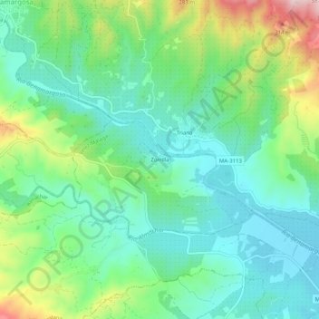
Name: Zorrilla topographic map, elevation, terrain.

Location: Zorrilla, Vélez-Málaga, La Axarquía, Málaga, Andalucía, 29718, España (36.79544 -4.19009 36.83544 -4.15009)

Average elevation: 134 m

Minimum elevation: 39 m

Maximum elevation: 364 m

Other topographic maps

Click on a map to view its topography, its elevation and its terrain.

Gear up for your next adventure:

Camping Essentials - All-in-one gear for a comfortable camping trip
💧Collapsible Water Bottle - Space-saving water bottle for outdoor activities
🧥Fleece Jacket - Warm and lightweight jacket for layering
🪑Ultralight Camping Stool - Compact seating for rest stops during long hikes
🎒Hiking Daypack - Lightweight and durable backpacks for day trips and excursions

As an Amazon Associate, this site earns from qualifying purchases at no extra cost to you.