
Thank you for supporting this site ❤️
Make a donation
Make a donation
Gear up for your next adventure:
As an Amazon Associate, this site earns from qualifying purchases at no extra cost to you.
Akan topographic map
Click on the map to display elevation.
Thank you for supporting this site ❤️
Make a donation
Make a donation
Gear up for your next adventure:
As an Amazon Associate, this site earns from qualifying purchases at no extra cost to you.
About this map
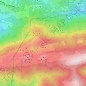
Name: Akan topographic map, elevation, terrain.
Location: Akan, Basaburúa Mayor, Larraun-Leitzaldea, España (43.07248 -1.86239 43.07258 -1.86229)
Average elevation: 870 m
Minimum elevation: 552 m
Maximum elevation: 1,146 m
Thank you for supporting this site ❤️
Make a donation
Make a donation
Gear up for your next adventure:
As an Amazon Associate, this site earns from qualifying purchases at no extra cost to you.