
La Codosera topographic map
Interactive map
Click on the map to display elevation.
About this map
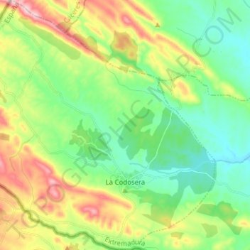
Name: La Codosera topographic map, elevation, terrain.
Location: La Codosera, Tierra de Badajoz, Badajoz, Extremadura, España (39.18043 -7.24802 39.27826 -7.12813)
Average elevation: 369 m
Minimum elevation: 272 m
Maximum elevation: 559 m