
Canlaon topographic map
Interactive map
Click on the map to display elevation.
About this map
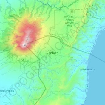
Name: Canlaon topographic map, elevation, terrain.
Location: Canlaon, Negros Oriental, Central Visayas, 6223, Philippines (10.22661 123.06449 10.54661 123.38449)
Average elevation: 428 m
Minimum elevation: -2 m
Maximum elevation: 2,426 m