
Thank you for supporting this site ❤️
Make a donation
Make a donation
Gear up for your next adventure:
As an Amazon Associate, this site earns from qualifying purchases at no extra cost to you.
Yılanlı topographic map
Click on the map to display elevation.
Thank you for supporting this site ❤️
Make a donation
Make a donation
Gear up for your next adventure:
As an Amazon Associate, this site earns from qualifying purchases at no extra cost to you.
About this map
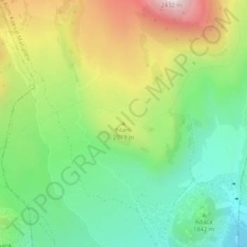
Name: Yılanlı topographic map, elevation, terrain.
Location: Yılanlı, Develi, Kayseri, Centraal-Anatolië, Turkije (38.46725 35.47815 38.46735 35.47825)
Average elevation: 1,935 m
Minimum elevation: 1,635 m
Maximum elevation: 2,411 m
Thank you for supporting this site ❤️
Make a donation
Make a donation
Gear up for your next adventure:
As an Amazon Associate, this site earns from qualifying purchases at no extra cost to you.