
Thank you for supporting this site ❤️
Make a donation
Make a donation
Gear up for your next adventure:
As an Amazon Associate, this site earns from qualifying purchases at no extra cost to you.
Foumlal topographic map
Click on the map to display elevation.
Thank you for supporting this site ❤️
Make a donation
Make a donation
Gear up for your next adventure:
As an Amazon Associate, this site earns from qualifying purchases at no extra cost to you.
About this map
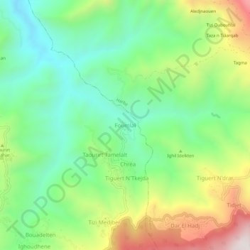
Name: Foumlal topographic map, elevation, terrain.
Location: Foumlal, Guenzet, Guenzet District, Setif, Algeria (36.32138 4.84563 36.36138 4.88563)
Average elevation: 928 m
Minimum elevation: 622 m
Maximum elevation: 1,474 m
Thank you for supporting this site ❤️
Make a donation
Make a donation
Gear up for your next adventure:
As an Amazon Associate, this site earns from qualifying purchases at no extra cost to you.