
Villa Italia topographic map
Interactive map
Click on the map to display elevation.
About this map
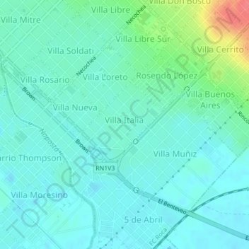
Name: Villa Italia topographic map, elevation, terrain.
Average elevation: 18 m
Minimum elevation: 5 m
Maximum elevation: 66 m
Other topographic maps
Click on a map to view its topography, its elevation and its terrain.
Bahía Blanca
Argentina > Buenos Aires > Bahía Blanca
Bahía Blanca, Partido de Bahía Blanca, Buenos Aires, Argentina
Average elevation: 37 m
Pacifico
Argentina > Buenos Aires > Bahía Blanca
Pacifico, Bahía Blanca, Partido de Bahía Blanca, Buenos Aires, Argentina
Average elevation: 24 m