
Thank you for supporting this site ❤️
Make a donation
Make a donation
Gear up for your next adventure:
As an Amazon Associate, this site earns from qualifying purchases at no extra cost to you.
Brandinhães topographic map
Click on the map to display elevation.
Thank you for supporting this site ❤️
Make a donation
Make a donation
Gear up for your next adventure:
As an Amazon Associate, this site earns from qualifying purchases at no extra cost to you.
About this map
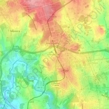
Name: Brandinhães topographic map, elevation, terrain.
Location: Brandinhães, Cidade da Maia, Maia, Porto, 4470-153, Portugal (41.21880 -8.64757 41.25880 -8.60757)
Average elevation: 79 m
Minimum elevation: 23 m
Maximum elevation: 129 m
Thank you for supporting this site ❤️
Make a donation
Make a donation
Gear up for your next adventure:
As an Amazon Associate, this site earns from qualifying purchases at no extra cost to you.