
Barneveld topographic map
Click on the map to display elevation.
About this map
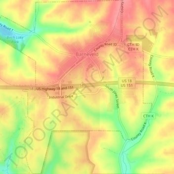
Name: Barneveld topographic map, elevation, terrain.
Location: Barneveld, Iowa County, Wisconsin, United States (42.99519 -89.91801 43.02440 -89.88099)
Average elevation: 350 m
Minimum elevation: 293 m
Maximum elevation: 385 m
Other topographic maps
Click on a map to view its topography, its elevation and its terrain.
Blue Mound State Park
United States > Wisconsin > Iowa County > Town of Brigham
Average elevation: 416 m
Governor Dodge State Park
United States > Wisconsin > Iowa County > Town of Dodgeville
Average elevation: 336 m