Geolocate

Bakhmaro topographic map

Click on the map to display elevation.

About this map

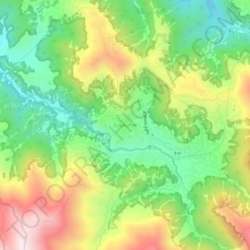
Name: Bakhmaro topographic map, elevation, terrain.

Location: Bakhmaro, Chokhatauri Municipality, Guria, 4900, Georgia (41.83127 42.30448 41.87127 42.34448)

Average elevation: 1,988 m

Minimum elevation: 1,715 m

Maximum elevation: 2,376 m

Gear up for your next adventure:

🔭Compact Binoculars - Lightweight optics for scouting trails and wildlife
🧥Insulated Jacket - Keep warm in cold outdoor conditions
🧦Outdoor Socks - Durable socks designed for hiking and outdoor sports
🎒Hiking Backpack - Lightweight and ergonomic backpacks for day hikes or multi-day treks
🍽️Titanium Camping Spork - Ultralight and indestructible eating utensil

As an Amazon Associate, this site earns from qualifying purchases at no extra cost to you.