
Thank you for supporting this site ❤️
Make a donation
Make a donation
Gear up for your next adventure:
As an Amazon Associate, this site earns from qualifying purchases at no extra cost to you.
Fobane topographic map
Click on the map to display elevation.
Thank you for supporting this site ❤️
Make a donation
Make a donation
Gear up for your next adventure:
As an Amazon Associate, this site earns from qualifying purchases at no extra cost to you.
About this map
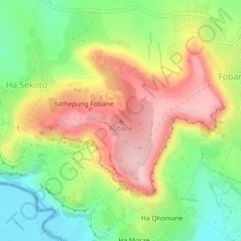
Name: Fobane topographic map, elevation, terrain.
Location: Fobane, Ha Sekoto, Leribe District, Lesotho (-29.05620 27.86202 -29.05610 27.86212)
Average elevation: 1,648 m
Minimum elevation: 1,539 m
Maximum elevation: 1,769 m
Thank you for supporting this site ❤️
Make a donation
Make a donation
Gear up for your next adventure:
As an Amazon Associate, this site earns from qualifying purchases at no extra cost to you.