Geolocate

Anif topographic map

Click on the map to display elevation.

About this map

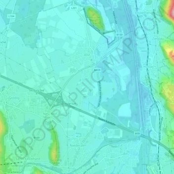
Name: Anif topographic map, elevation, terrain.

Location: Anif, Flachgau, Salzburg, 5081, Austria (47.72298 13.04651 47.76201 13.08290)

Average elevation: 443 m

Minimum elevation: 418 m

Maximum elevation: 605 m

Gear up for your next adventure:

🧴Insect Repellent - Protect yourself from bugs during outdoor adventures
🥾Trekking Poles - Adjustable trekking poles to reduce knee stress and improve stability
🥾Mountain Hiking Shoes - Shoes with superior grip for mountainous terrain
🥤Collapsible Travel Cup - Saves space and weight in your mess kit
🔭Compact Binoculars - Lightweight optics for scouting trails and wildlife

As an Amazon Associate, this site earns from qualifying purchases at no extra cost to you.