
Thank you for supporting this site ❤️
Make a donation
Make a donation
Gear up for your next adventure:
As an Amazon Associate, this site earns from qualifying purchases at no extra cost to you.
Ontiñena topographic map
Click on the map to display elevation.
Thank you for supporting this site ❤️
Make a donation
Make a donation
Gear up for your next adventure:
As an Amazon Associate, this site earns from qualifying purchases at no extra cost to you.
About this map
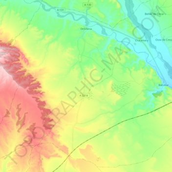
Name: Ontiñena topographic map, elevation, terrain.
Location: Ontiñena, Bajo Cinca, Huesca, Aragón, España (41.53390 -0.05887 41.70455 0.13697)
Average elevation: 291 m
Minimum elevation: 138 m
Maximum elevation: 540 m
Thank you for supporting this site ❤️
Make a donation
Make a donation
Gear up for your next adventure:
As an Amazon Associate, this site earns from qualifying purchases at no extra cost to you.