Geolocate

Plant topographic map

Click on the map to display elevation.

About this map

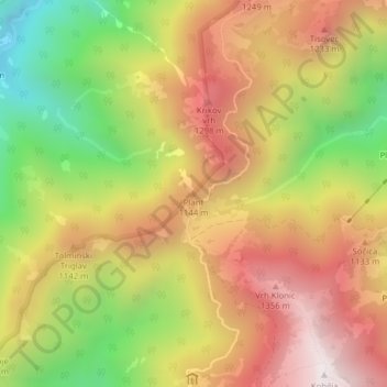
Name: Plant topographic map, elevation, terrain.

Location: Plant, Tolmin, Slovenia (46.20275 13.78216 46.20285 13.78226)

Average elevation: 952 m

Minimum elevation: 362 m

Maximum elevation: 1,458 m

Other topographic maps

Click on a map to view its topography, its elevation and its terrain.

Banjšice

Slovenia > Tolmin

Average elevation: 685 m

Gear up for your next adventure:

🏃Hydration Running Vest - Carry water and maps close to your body for speed
🔦LED Headtorch - Bright and durable light for night activities
🧤Insulated Winter Gloves - Heavy-duty protection for sub-zero Canadian adventures
🧴Sunscreen SPF - Broad-spectrum sunscreen for outdoor activities
🗺️Topographic Maps - Detailed maps to explore trails, mountains, and wilderness areas

As an Amazon Associate, this site earns from qualifying purchases at no extra cost to you.