Geolocate

Manjirón topographic map

Click on the map to display elevation.

About this map

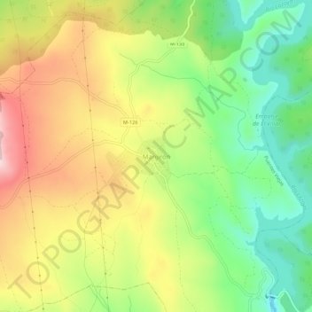
Name: Manjirón topographic map, elevation, terrain.

Location: Manjirón, Puentes Viejas, Comunidad de Madrid, 28754, España (40.94540 -3.60288 40.98540 -3.56288)

Average elevation: 995 m

Minimum elevation: 871 m

Maximum elevation: 1,140 m

Gear up for your next adventure:

🧭Orienteering Kit - Tools for map reading and navigation in the wild
🧶550 Survival Paracord - Versatile utility cord for emergency repairs and rigging
🧥Ultralight Puffy Jacket - Maximum warmth that packs down to the size of an orange
🦌Outdoor Trail Camera - Monitor wildlife activity near your favorite spots
🛰️Satellite Messenger - Emergency communication for areas with no cell service

As an Amazon Associate, this site earns from qualifying purchases at no extra cost to you.