

Montemorelos topographic map
Click on the map to display elevation.
Montemorelos
In 1637, Governor Martín de Zavala promised a large tract of land in central Nuevo León to Captain Alonso de León on condition that, in less than a year, a colonial settlement is built and populated inside its borders. De León distributed the estate to his children and one of them, Alonso de León González ("The younger"), established his property in the northern banks of the Pilón River, organized an outpost and dedicated it to Our Lady of Regla, a black Madonna venerated by Catholics in Chipiona, Cádiz. The settlement grew rapidly and soon the residents requested the intervention of the Bishop of Guadalajara so that a church could be built and dedicated to St Matthew. The elevation of this parochial church in 1665 marks the foundation of modern-day Montemorelos.
About this map
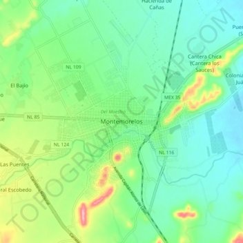
Name: Montemorelos topographic map, elevation, terrain.
Location: Montemorelos, Nuevo León, 67530, Mexico (25.14866 -99.86935 25.22866 -99.78935)
Average elevation: 418 m
Minimum elevation: 376 m
Maximum elevation: 522 m