Geolocate

Pandan topographic map

Click on the map to display elevation.

About this map

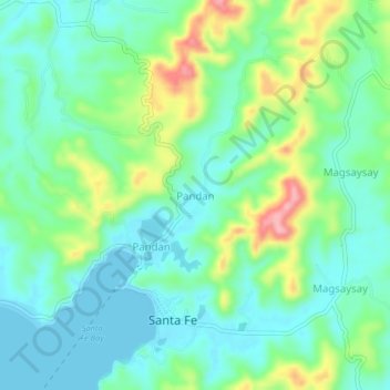
Name: Pandan topographic map, elevation, terrain.

Location: Pandan, Santa Fe, Romblon, Mimaropa, 5508, Philippines (12.14702 121.97776 12.18702 122.01776)

Average elevation: 38 m

Minimum elevation: 0 m

Maximum elevation: 133 m

Gear up for your next adventure:

🛁Quick-Dry Microfiber Towel - Space-saving towel that dries rapidly on the move
🔪Outdoor Multitool - Versatile tool for repairs and food prep in the wild
🧰Survival Kit - Essential gear for emergencies in the wilderness
🧴Waterproofing Spray - Restore the DWR coating on jackets and tents
🧥Fleece Jacket - Warm and lightweight jacket for layering

As an Amazon Associate, this site earns from qualifying purchases at no extra cost to you.