Geolocate

Hartford topographic map

Click on the map to display elevation.

About this map

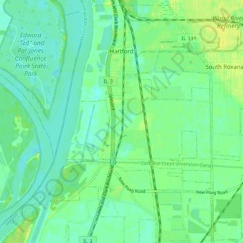
Name: Hartford topographic map, elevation, terrain.

Location: Hartford, Madison County, Illinois, 62048, United States (38.78542 -90.11973 38.84610 -90.06702)

Average elevation: 129 m

Minimum elevation: 121 m

Maximum elevation: 141 m

Other topographic maps

Click on a map to view its topography, its elevation and its terrain.

North Alton

United States > Illinois > Madison County > Godfrey

Average elevation: 179 m

North Venice

United States > Illinois > Madison County > Venice

Average elevation: 126 m

Bethalto

United States > Illinois > Madison County > Bethalto > Bethalto

Average elevation: 156 m

North Venice

United States > Illinois > Madison County > Venice

Average elevation: 126 m

Alton

United States > Illinois > Madison County > Alton

Average elevation: 147 m

Gear up for your next adventure:

🥾Hiking Gaiters - Protect legs and shoes from mud, snow, and debris
🧴Sunscreen SPF - Broad-spectrum sunscreen for outdoor activities
💧Filtered Water Bottle - Safe drinking water on the go
🧢Hiking Hat - Sun-protective and breathable hats for long treks
🧊Insulated Water Bottle - Keeps drinks cold in summer and prevents freezing in winter

As an Amazon Associate, this site earns from qualifying purchases at no extra cost to you.