
Thank you for supporting this site ❤️
Make a donation
Make a donation
Gear up for your next adventure:
As an Amazon Associate, this site earns from qualifying purchases at no extra cost to you.
Pont-Viau topographic map
Click on the map to display elevation.
Thank you for supporting this site ❤️
Make a donation
Make a donation
Gear up for your next adventure:
As an Amazon Associate, this site earns from qualifying purchases at no extra cost to you.
About this map
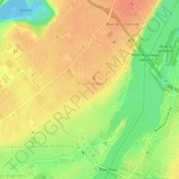
Name: Pont-Viau topographic map, elevation, terrain.
Location: Pont-Viau, Laval (région administrative), Québec, Canada (45.55585 -73.70281 45.58562 -73.66745)
Average elevation: 29 m
Minimum elevation: -11 m
Maximum elevation: 48 m
Thank you for supporting this site ❤️
Make a donation
Make a donation
Gear up for your next adventure:
As an Amazon Associate, this site earns from qualifying purchases at no extra cost to you.
Other topographic maps
Click on a map to view its topography, its elevation and its terrain.
Berge de la Plage-Jacques-Cartier
Canada > Québec > Laval (région administrative)
Average elevation: 29 m