Geolocate

Matagalls topographic map

Click on the map to display elevation.

About this map

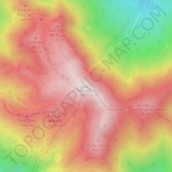
Name: Matagalls topographic map, elevation, terrain.

Location: Matagalls, Viladrau, Osona, Gerona, Cataluña, 17406, España (41.80875 2.38267 41.80885 2.38277)

Average elevation: 1,394 m

Minimum elevation: 925 m

Maximum elevation: 1,686 m

Gear up for your next adventure:

🧢Sun Hat - Wide-brim hat for sun protection
🕯️Camping Lantern - Illuminates your entire campsite with high-efficiency LEDs
Camping Tent - Weather-resistant tents suitable for 2 to 6 people
🧥Fleece Jacket - Warm and lightweight jacket for layering
Camping Coffee Maker - Brew fresh coffee anywhere on the topographic map

As an Amazon Associate, this site earns from qualifying purchases at no extra cost to you.