Geolocate

Le Bagnese topographic map

Click on the map to display elevation.

About this map

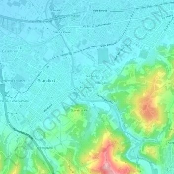
Name: Le Bagnese topographic map, elevation, terrain.

Location: Le Bagnese, Scandicci, Florence, Tuscany, 50142, Italy (43.73517 11.17764 43.77517 11.21764)

Average elevation: 66 m

Minimum elevation: 36 m

Maximum elevation: 187 m

Gear up for your next adventure:

🧥Insulated Jacket - Keep warm in cold outdoor conditions
🧴Sunscreen SPF - Broad-spectrum sunscreen for outdoor activities
🥫Freeze-Dried Meals - Lightweight, high-calorie nutrition for multi-day treks
🧢Outdoor Cap - Protective cap for sun and rain during hikes
🛁Quick-Dry Microfiber Towel - Space-saving towel that dries rapidly on the move

As an Amazon Associate, this site earns from qualifying purchases at no extra cost to you.