Geolocate

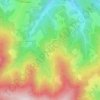
Pölstal topographic map

Click on the map to display elevation.

About this map

Name: Pölstal topographic map, elevation, terrain.

Location: Pölstal, Bezirk Murtal, Styria, Austria (47.22038 14.24094 47.43892 14.55623)

Average elevation: 1,502 m

Minimum elevation: 780 m

Maximum elevation: 2,370 m

Other topographic maps

Click on a map to view its topography, its elevation and its terrain.
Landschach

Austria > Styria > Bezirk Murtal > Knittelfeld

Average elevation: 691 m

Großer Bösenstein

Austria > Styria > Bezirk Murtal > Hohentauern

Average elevation: 2,011 m

Schönberg

Austria > Styria > Bezirk Murtal > Flatschach

Average elevation: 806 m

Unzmarkt

Austria > Styria > Bezirk Murtal > Unzmarkt-Frauenburg

Average elevation: 1,009 m

Kattigar

Austria > Styria > Bezirk Murtal > Flatschach

Average elevation: 728 m

Kattigar

Austria > Styria > Bezirk Murtal > Flatschach

Average elevation: 728 m

Flatschach

Austria > Styria > Bezirk Murtal

Average elevation: 751 m

Kattigar

Austria > Styria > Bezirk Murtal > Flatschach

Average elevation: 728 m

Alm Rainer

Austria > Styria > Bezirk Murtal > Judenburg > Reifling

Average elevation: 1,067 m

Hetzendorf

Austria > Styria > Bezirk Murtal

Average elevation: 711 m

Alm Rainer

Austria > Styria > Bezirk Murtal > Judenburg > Reifling

Average elevation: 1,067 m

Gear up for your next adventure:

🪑Insulated Seat Pad - Protect your seat from cold rocks and wet logs
🛶Waterproof Dry Bags - Keep electronics and clothes dry during river crossings
🧢Outdoor Visor - Breathable visor for sunny hikes
👟Trail Running Shoes - Agile footwear for fast-paced topographic exploration
🎒Hiking Backpack - Lightweight and ergonomic backpacks for day hikes or multi-day treks

As an Amazon Associate, this site earns from qualifying purchases at no extra cost to you.