Geolocate

Entrèves topographic map

Click on the map to display elevation.

About this map

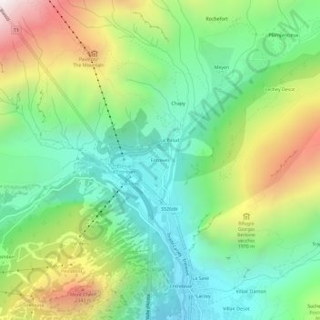
Name: Entrèves topographic map, elevation, terrain.

Location: Entrèves, Courmayeur, Aosta Valley, 11013, Italy (45.79585 6.94266 45.83585 6.98266)

Average elevation: 1,702 m

Minimum elevation: 1,192 m

Maximum elevation: 2,639 m

Gear up for your next adventure:

💡LED Headlamp - Hands-free illumination for night hiking and camping
🥾Mountaineering Boots - Supportive boots for climbing and high-altitude hiking
💧Reusable Water Bottle - Durable water bottles for hydration on trails
🧴Outdoor Sunscreen - High SPF protection for high-altitude UV exposure
🛁Quick-Dry Microfiber Towel - Space-saving towel that dries rapidly on the move

As an Amazon Associate, this site earns from qualifying purchases at no extra cost to you.