Geolocate

Seebach topographic map

Click on the map to display elevation.

About this map
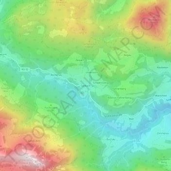
Name: Seebach topographic map, elevation, terrain.

Location: Seebach, Oberaudorf, Landkreis Rosenheim, Bayern, Deutschland (47.64512 12.09444 47.68512 12.13444)

Average elevation: 931 m

Minimum elevation: 565 m

Maximum elevation: 1,587 m

Gear up for your next adventure:

🧳Compression Sacks - Maximize space in your backpack by shrinking gear
🔋Emergency Crank Radio - Weather alerts and power without needing batteries
🎒Hiking Daypack - Lightweight and durable backpacks for day trips and excursions
🛶Kayak Dry Bag - Waterproof storage for kayaking adventures
🧭GPS Tracker - Track your location in remote areas safely

As an Amazon Associate, this site earns from qualifying purchases at no extra cost to you.