
Thank you for supporting this site ❤️
Make a donation
Make a donation
Gear up for your next adventure:
As an Amazon Associate, this site earns from qualifying purchases at no extra cost to you.
Queimadas topographic map
Click on the map to display elevation.
Thank you for supporting this site ❤️
Make a donation
Make a donation
Gear up for your next adventure:
As an Amazon Associate, this site earns from qualifying purchases at no extra cost to you.
About this map
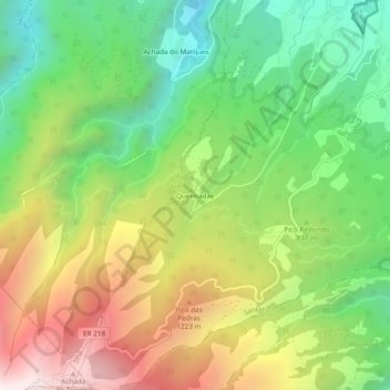
Name: Queimadas topographic map, elevation, terrain.
Location: Queimadas, Santana, Madeira, 9230-117, Portugal (32.76360 -16.92604 32.80360 -16.88604)
Average elevation: 841 m
Minimum elevation: 241 m
Maximum elevation: 1,679 m
Thank you for supporting this site ❤️
Make a donation
Make a donation
Gear up for your next adventure:
As an Amazon Associate, this site earns from qualifying purchases at no extra cost to you.