
Thank you for supporting this site ❤️
Make a donation
Make a donation
Gear up for your next adventure:
As an Amazon Associate, this site earns from qualifying purchases at no extra cost to you.
Héliopolis topographic map
Click on the map to display elevation.
Thank you for supporting this site ❤️
Make a donation
Make a donation
Gear up for your next adventure:
As an Amazon Associate, this site earns from qualifying purchases at no extra cost to you.
About this map
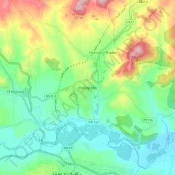
Name: Héliopolis topographic map, elevation, terrain.
Location: Héliopolis, Heliopolis, Daïra Heliopolis, Guelma, 24008, Algérie (36.46579 7.40230 36.54579 7.48230)
Average elevation: 286 m
Minimum elevation: 169 m
Maximum elevation: 531 m
Thank you for supporting this site ❤️
Make a donation
Make a donation
Gear up for your next adventure:
As an Amazon Associate, this site earns from qualifying purchases at no extra cost to you.