Geolocate

Persi topographic map

Click on the map to display elevation.

About this map

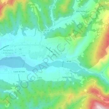
Name: Persi topographic map, elevation, terrain.

Location: Persi, Borghetto di Borbera, Alessandria, Piemonte, Italia (44.70973 8.94934 44.74973 8.98934)

Average elevation: 375 m

Minimum elevation: 264 m

Maximum elevation: 670 m

Gear up for your next adventure:

🥾Waterproof Trail Shoes - Shoes designed to handle wet terrain
🥾Hiking Leggings - Comfortable leggings for outdoor activities
🥾Hiking Shoes - Durable and comfortable shoes for trail hiking
🕯️Camping Lantern - Illuminates your entire campsite with high-efficiency LEDs
🛶Waterproof Dry Bags - Keep electronics and clothes dry during river crossings

As an Amazon Associate, this site earns from qualifying purchases at no extra cost to you.