Geolocate

Soreng topographic map

Click on the map to display elevation.

About this map

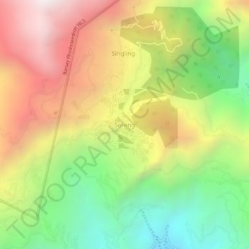
Name: Soreng topographic map, elevation, terrain.

Location: Soreng, Sikkim, 737121, India (27.15064 88.17946 27.19064 88.21946)

Average elevation: 1,531 m

Minimum elevation: 735 m

Maximum elevation: 2,419 m

Other topographic maps

Click on a map to view its topography, its elevation and its terrain.

Barsey Rhododendron WLS

India > Sikkim > Soreng > Singling

Average elevation: 2,115 m

Gear up for your next adventure:

🧢Sun Hat - Wide-brim hat for sun protection
🎒Hiking Backpack - Lightweight and ergonomic backpacks for day hikes or multi-day treks
Lightweight Camping Tent - Portable shelter optimized for Canadian backcountry camping
🧰Multitool Knife - Compact and versatile tool for outdoor use
🥾Hiking Gaiters - Protect legs and shoes from mud, snow, and debris

As an Amazon Associate, this site earns from qualifying purchases at no extra cost to you.