Geolocate

Spring Lake Township topographic map

Click on the map to display elevation.

About this map

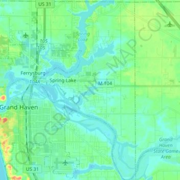
Name: Spring Lake Township topographic map, elevation, terrain.

Location: Spring Lake Township, Ottawa County, Michigan, United States (43.02511 -86.27181 43.11836 -86.14545)

Average elevation: 185 m

Minimum elevation: 174 m

Maximum elevation: 224 m

Other topographic maps

Click on a map to view its topography, its elevation and its terrain.

Eastmanville

United States > Michigan > Ottawa County

Average elevation: 192 m

Gear up for your next adventure:

🦌Outdoor Trail Camera - Monitor wildlife activity near your favorite spots
🩹Moleskin Blister Pads - Direct protection for painful foot pressure points
🕯️Camping Lantern - Illuminates your entire campsite with high-efficiency LEDs
🚑Survival Whistle - Signal for help across long distances in mountains
🐕Hiking Dog Pack - Let your canine companion carry their own water and food

As an Amazon Associate, this site earns from qualifying purchases at no extra cost to you.