
Thank you for supporting this site ❤️
Make a donation
Make a donation
Gear up for your next adventure:
As an Amazon Associate, this site earns from qualifying purchases at no extra cost to you.
Sading topographic map
Click on the map to display elevation.
Thank you for supporting this site ❤️
Make a donation
Make a donation
Gear up for your next adventure:
As an Amazon Associate, this site earns from qualifying purchases at no extra cost to you.
About this map
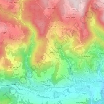
Name: Sading topographic map, elevation, terrain.
Location: Sading, Pöggstall, Bezirk Melk, Lower Austria, 3650, Austria (48.30905 15.16399 48.34905 15.20399)
Average elevation: 638 m
Minimum elevation: 421 m
Maximum elevation: 869 m
Thank you for supporting this site ❤️
Make a donation
Make a donation
Gear up for your next adventure:
As an Amazon Associate, this site earns from qualifying purchases at no extra cost to you.