Geolocate

Vallter2000 topographic map

Click on the map to display elevation.

About this map

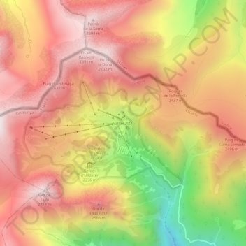
Name: Vallter2000 topographic map, elevation, terrain.

Location: Vallter2000, Setcases, Ripollés, Gerona, Cataluña, 17869, España (42.40648 2.24509 42.44648 2.28509)

Average elevation: 2,328 m

Minimum elevation: 1,696 m

Maximum elevation: 2,727 m

Gear up for your next adventure:

🧭Orienteering Kit - Tools for map reading and navigation in the wild
🛌Down Sleeping Bag - Superior warmth-to-weight ratio for cold nights
Lightweight Backpacking Tent - Compact tent for efficient hiking trips
🦟Insect Repellent - Keep mosquitoes and black flies away in wooded areas
💡Solar Camping Lamp - Eco-friendly lighting for campsites

As an Amazon Associate, this site earns from qualifying purchases at no extra cost to you.