
Schloss Adolfsburg topographic map
Interactive map
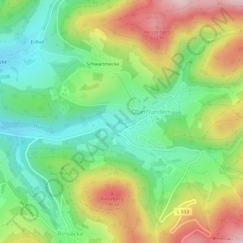
Click on the map to display elevation.
About this map
Name: Schloss Adolfsburg topographic map, elevation, terrain.
Average elevation: 473 m
Minimum elevation: 362 m
Maximum elevation: 636 m
Other topographic maps
Click on a map to view its topography, its elevation and its terrain.
Hohe Lohe
Deutschland > Nordrhein-Westfalen > Kirchhundem
Hohe Lohe, Kirchhundem, Kreis Olpe, Nordrhein-Westfalen, 57399, Deutschland
Average elevation: 412 m
Rinsecke
Deutschland > Nordrhein-Westfalen > Kirchhundem
Rinsecke, Kirchhundem, Kreis Olpe, Regierungsbezirk Arnsberg, Nordrhein-Westfalen, Deutschland
Average elevation: 451 m