Geolocate

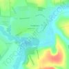
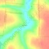
Bohodarivka topographic map

Click on the map to display elevation.

About this map

Name: Bohodarivka topographic map, elevation, terrain.

Location: Bohodarivka, Dobrovelychkivka Settlement Hromada, Novoukrainka Raion, Kirovohrad Oblast, 27012, Ukraine (48.54005 31.15530 48.56428 31.20711)

Average elevation: 179 m

Minimum elevation: 148 m

Maximum elevation: 203 m

Other topographic maps

Click on a map to view its topography, its elevation and its terrain.

Yaremivka

Ukraine > Kirovohrad Oblast

Average elevation: 112 m

Tyshkivka

Ukraine > Kirovohrad Oblast

Average elevation: 174 m

Onufriivka

Ukraine > Kirovohrad Oblast

Average elevation: 107 m

Novoiehorivka

Ukraine > Kirovohrad Oblast

Average elevation: 199 m

Lypniazhka

Ukraine > Kirovohrad Oblast

Average elevation: 145 m

Svitlovodsk

Ukraine > Kirovohrad Oblast

Average elevation: 93 m

Polokhivka

Ukraine > Kirovohrad Oblast

Average elevation: 165 m

Medove

Ukraine > Kirovohrad Oblast

Average elevation: 167 m

Gear up for your next adventure:

🛌Insulated Sleeping Pad - Critical thermal barrier between you and the cold ground
📷Outdoor Action Camera - Capture high-elevation views and rugged adventures
🛁Quick-Dry Microfiber Towel - Space-saving towel that dries rapidly on the move
🥾Trekking Boots - Durable boots for long-distance trekking
⛺Camping Groundsheet - Protect your tent from moisture and dirt

As an Amazon Associate, this site earns from qualifying purchases at no extra cost to you.