Geolocate

Kiambu topographic map

Click on the map to display elevation.

About this map

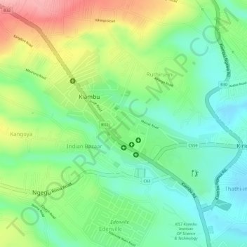
Name: Kiambu topographic map, elevation, terrain.

Location: Kiambu, Kiambu County, Kenya (-1.17588 36.82133 -1.16283 36.83700)

Average elevation: 1,704 m

Minimum elevation: 1,646 m

Maximum elevation: 1,792 m

Gear up for your next adventure:

🐕Hiking Dog Pack - Let your canine companion carry their own water and food
🥾Light Hiking Boots - Lightweight and comfortable boots for day hikes
🧦Thermal Socks - Warm socks for winter hiking or camping
🧴Waterproofing Spray - Restore the DWR coating on jackets and tents
Lightweight Backpacking Tent - Compact tent for efficient hiking trips

As an Amazon Associate, this site earns from qualifying purchases at no extra cost to you.