
Caernarfon topographic map
Interactive map
Click on the map to display elevation.
About this map
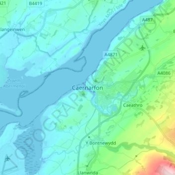
Name: Caernarfon topographic map, elevation, terrain.
Location: Caernarfon, Gwynedd, Pays de Galles, LL, Royaume-Uni (53.09903 -4.30919 53.17903 -4.22919)
Average elevation: 44 m
Minimum elevation: 0 m
Maximum elevation: 284 m