Geolocate

Louis Point topographic map

Click on the map to display elevation.

About this map

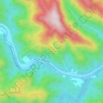
Name: Louis Point topographic map, elevation, terrain.

Location: Louis Point, Dalmorton, Clarence Valley Council, New South Wales, 2460, Australia (-29.88500 152.48111 -29.84500 152.52111)

Average elevation: 372 m

Minimum elevation: 175 m

Maximum elevation: 749 m

Other topographic maps

Click on a map to view its topography, its elevation and its terrain.

Sydney

Australia > New South Wales

Sydney's topography is characterized by a diverse landscape that seamlessly blends coastal features with inland plateaus. The city is divided into two primary regions: the relatively flat Cumberland Plain to the south and west of Sydney Harbour, and the elevated Hornsby Plateau to the north. The Cumberland…

Average elevation: 53 m

Goulburn

Australia > New South Wales

Owing to its elevation, Goulburn has an oceanic climate (Cfb) with warm summers and cool winters; with a high diurnal range. Its climate is variable much of the year, though generally dry with maximum temperatures ranging from 11.8 °C (53.2 °F) in July to 28.3 °C (82.9 °F) in January. Rainfall is…

Average elevation: 666 m

Newcastle

Australia > New South Wales

Average elevation: 5 m

Hornsby

Australia > New South Wales > Sydney

Average elevation: 160 m

Lane Cove National Park

Australia > New South Wales > Sydney

The park includes areas of land which are part of Ku-ring-gai, Ryde, and Hornsby local government areas with small areas of the park in Willoughby, Lane Cove and Hunter's Hill local government areas on the banks of the lower reaches of the river. The park is surrounded on all sides by developed suburban areas…

Average elevation: 81 m

Blue Mountains

Australia > New South Wales

A sandstone plateau dominated by a landscape of endless eucalyptus forests, the Blue Mountains are located at the top of a 470-million-year-old quartzite. In the Permian period, a shallow sea covered the region, when rivers brought shales, siltstones and mudstones. Then during the Mesozoic period, rivers…

Average elevation: 566 m

Parramatta

Australia > New South Wales

Average elevation: 22 m

Baulkham Hills

Australia > New South Wales

Average elevation: 93 m

Mudgee

Australia > New South Wales

Average elevation: 535 m

Ocean Shores

Australia > New South Wales

Average elevation: 12 m

Tweed Shire Council

Australia > New South Wales

Average elevation: 212 m

Sydney

Australia > New South Wales > Sydney

Average elevation: 23 m

Orange

Australia > New South Wales

Orange is a city in the Central Tablelands region of New South Wales, Australia. It is 254 km (158 mi) west of the state capital, Sydney [206 km (128 mi) on a great circle], at an altitude of 862 metres (2,828 ft). Orange had an estimated urban population of 40,493 as of June 2018 making the city a significant…

Average elevation: 852 m

Palm Beach

Australia > New South Wales > Sydney

Average elevation: 13 m

Deep Creek

Australia > New South Wales

Average elevation: 71 m

Oaklands

Australia > New South Wales

Average elevation: 125 m

Singleton Council

Australia > New South Wales

Average elevation: 238 m

Katoomba

Australia > New South Wales

Average elevation: 904 m

Maroubra

Australia > New South Wales

Average elevation: 27 m

Bowral

Australia > New South Wales

Average elevation: 690 m

Chatswood

Australia > New South Wales

Average elevation: 81 m

Manly Vale

Australia > New South Wales > Sydney

Average elevation: 34 m

Windsor

Australia > New South Wales > Sydney

Average elevation: 12 m

Oatley

Australia > New South Wales > Sydney

Average elevation: 24 m

North Bondi

Australia > New South Wales > Sydney

Average elevation: 22 m

Bilgola Plateau

Australia > New South Wales

The suburb is mainly residential, with two small rows of shops, a small park and a primary school located on the top of the plateau. Bilgola Beach on the eastern side features a surf club and kiosk. Rising to an elevation of 150m above sea level, the suburb has views of the beach and the ocean on the eastern…

Average elevation: 37 m

Stockton

Australia > New South Wales > Newcastle

Average elevation: 2 m

Strathfield

Australia > New South Wales > Sydney

Average elevation: 26 m

East Hills

Australia > New South Wales > Sydney

Average elevation: 15 m

Northern Beaches

Australia > New South Wales > Sydney

Average elevation: 67 m

New Berrima

Australia > New South Wales

Average elevation: 673 m

Binalong

Australia > New South Wales

Average elevation: 534 m

Wingham

Australia > New South Wales

Average elevation: 47 m

Goobarragandra

Australia > New South Wales

Average elevation: 877 m

Port Macquarie

Australia > New South Wales

Average elevation: 5 m

Glen Innes

Australia > New South Wales

Average elevation: 1,083 m

Blackheath

Australia > New South Wales

Blackheath (postcode: 2785) is an Australian town located near the highest point of the Blue Mountains, between Katoomba and Mount Victoria in New South Wales. The town's altitude is about 1,065 metres (3,494 ft) AHD  and it is located about 120 kilometres (75 mi) west north-west of Sydney, 11 kilometres…

Average elevation: 893 m

Seven Hills

Australia > New South Wales

Average elevation: 49 m

Asquith

Australia > New South Wales

Average elevation: 168 m

Crescent Head

Australia > New South Wales

Average elevation: 7 m

New England National Park

Australia > New South Wales

The park lies within the Eastern Australian temperate forests ecoregion. It is noted for the wide variety of plant and animal species. The diverse vegetation in the park includes sub-tropical, warm temperate and cool temperate rainforest in the higher altitudes. There are also areas of sclerophyll forest,…

Average elevation: 559 m

Ashby

Australia > New South Wales

Average elevation: 23 m

Lismore

Australia > New South Wales

Average elevation: 23 m

Gladstone

Australia > New South Wales

Average elevation: 2 m

Toorooka

Australia > New South Wales

Average elevation: 110 m

Belimbla Park

Australia > New South Wales

Average elevation: 356 m

Glenworth Valley

Australia > New South Wales

Average elevation: 115 m

Pearl Beach

Australia > New South Wales

Average elevation: 34 m

Bendemeer

Australia > New South Wales

Average elevation: 893 m

Kybeyan

Australia > New South Wales

Average elevation: 1,016 m

Woronora Dam

Australia > New South Wales

The wall of Woronora Dam is an engineering work imbued with a sense of high aesthetic value expressed through the long curved high wall set with the wide valley of the Woronora River. Upstream of the dam wall this setting is characterised by the broad expanse of the pool of water bordered by the crests of the…

Average elevation: 198 m

Uriarra

Australia > New South Wales

Average elevation: 808 m

Dry Plain

Australia > New South Wales

Average elevation: 1,104 m

Bondi State Forest

Australia > New South Wales

Average elevation: 711 m

South West Rocks

Australia > New South Wales

Average elevation: 9 m

Armidale

Australia > New South Wales

Average elevation: 1,036 m

Byron Bay

Australia > New South Wales

Byron Bay, located in northeastern New South Wales, Australia, is characterized by diverse topography shaped by its geological history. The town is part of the erosion caldera of the ancient Tweed Volcano, which erupted approximately 23 million years ago, resulting in the rich volcanic soils that define the…

Average elevation: 7 m

Rutherford

Australia > New South Wales

Average elevation: 23 m

Nowra

Australia > New South Wales

Average elevation: 21 m

Pittwater

Australia > New South Wales

Average elevation: 45 m

Eden

Australia > New South Wales

Average elevation: 55 m

North Sydney

Australia > New South Wales > Sydney

Average elevation: 50 m

Hunter River

Australia > New South Wales

Average elevation: 344 m

Talbingo

Australia > New South Wales

Average elevation: 740 m

Yarrowitch

Australia > New South Wales

Average elevation: 890 m

Ettalong Beach

Australia > New South Wales

Average elevation: 9 m

Cooma

Australia > New South Wales

Average elevation: 869 m

Anna Bay

Australia > New South Wales

Average elevation: 7 m

Cassilis

Australia > New South Wales

Average elevation: 560 m

Kiandra

Australia > New South Wales

Average elevation: 1,432 m

Thredbo

Australia > New South Wales

Average elevation: 1,780 m

Mount Victoria

Australia > New South Wales

Mount Victoria (postcode: 2786) is a small township in the Blue Mountains of New South Wales, Australia. Mount Victoria is geographically the western most village and suburb of Greater Sydney on the great western highway in the City of Blue Mountains, located about 120 kilometres (75 mi) west-northwest by road…

Average elevation: 901 m

Smithfield

Australia > New South Wales > Sydney

Established in 1836, Smithfield was the first major settlement of the Fairfield LGA. The original 1838 summary plan of Smithfield shows the suburb laid out in a grid pattern with most of the streets having the same names as they do today. Its altitude ranges from 21 to 48 m (69 to 157 ft) above sea level.…

Average elevation: 33 m

Capertee

Australia > New South Wales

Average elevation: 757 m

Urunga

Australia > New South Wales

Average elevation: 13 m

Carlingford

Australia > New South Wales > Sydney

Average elevation: 98 m

Campbelltown

Australia > New South Wales

Average elevation: 96 m

Yass

Australia > New South Wales

Yass is located 280 km south-west of Sydney, on the Hume Highway. The Yass River, which is a tributary of the Murrumbidgee River, flows through the town. Yass is 59 km from Canberra; lying at an elevation of 505 m AMSL.

Average elevation: 533 m

Gear up for your next adventure:

🧥Thermal Fleece Jacket - Versatile insulation for changing mountain temperatures
👖Convertible Hiking Pants - Zip-off legs to adapt to changing weather conditions
Camping Tent - Weather-resistant tents suitable for 2 to 6 people
💧Reusable Water Bottle - Durable water bottles for hydration on trails
Camping Groundsheet - Protect your tent from moisture and dirt

As an Amazon Associate, this site earns from qualifying purchases at no extra cost to you.