
Lewisham topographic map
Interactive map
Click on the map to display elevation.
About this map
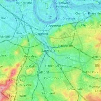
Name: Lewisham topographic map, elevation, terrain.
Location: Lewisham, Londen, Greater London, Engeland, SE13 6BB, VK (51.42243 -0.05013 51.50243 0.02987)
Average elevation: 28 m
Minimum elevation: -2 m
Maximum elevation: 113 m